


Source: California is burning again, and satellites are showing the scope of the damage.
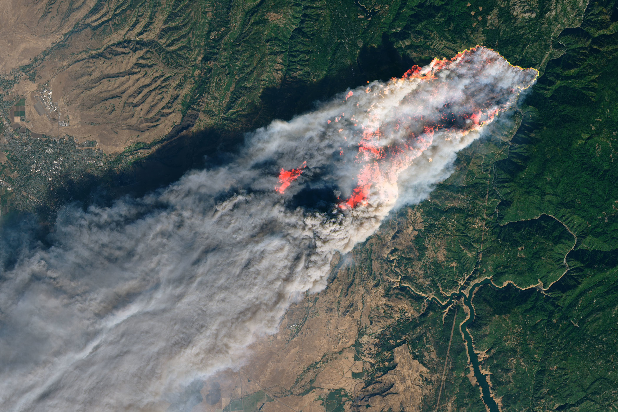
The Landsat 8 spacecraft, which is run jointly by NASA and the U.S. Geological Survey (USGS), captured dramatic imagery Thursday (Nov. 8) of the Camp Fire. The fast-moving blaze has destroyed the Northern California town of Paradise, killed at least nine people and sent smoke billowing across much of the state.
NASA’s Terra satellite also snapped a photo of the Camp Fire’s plume, in a wide shot that included a view of the Hill and Woolsey fires in Southern California. [In Photos: The 2018 California Wildfires as Seen from Space]
The Camp Fire started at about 6:30 a.m. PST Thursday. By Friday evening (Nov. 9), it had scorched about 90,000 acres (36,400 hectares) and remained just 5 percent contained, according to the California Department of Forestry and Fire Protection (Cal Fire).
Together, the Woolsey and Hill fires had burned nearly 40,000 acres (16,200 hectares) in Ventura County, just north of Los Angeles, by Friday evening.
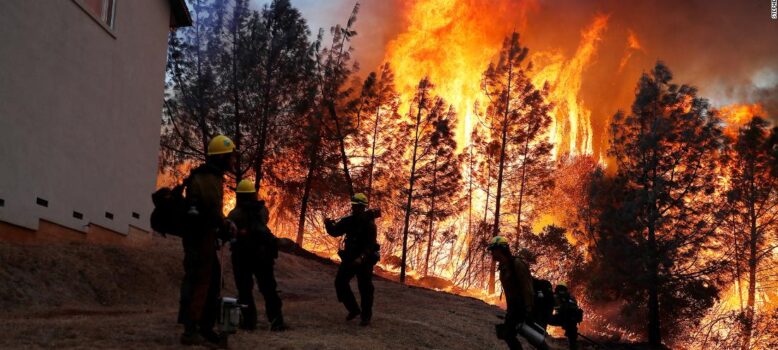
Sad stuff.
Certainly hoping for everyone’s safe departure, and as you can see from these videos, it’s basically a scene out of a horror movie for these people:
https://www.instagram.com/p/BqBCFLmHVuN/
https://www.instagram.com/p/BqBFIodB36F/
https://www.instagram.com/p/Bp_WEXQFm1U/
https://www.instagram.com/p/BqCuqpJnX4b/
Shug McSween
Shug McSween is a veteran here at DeanBlundell.com and has been contributing since day one. A sports nut with a sophisticated opinion, expect McSween to cover any and everything he's passionate about. When he's not busy writing and editing for our crew, McSween likes to get away via fairways and greens. He also contributes to The Hockey Writers, NHLTradeRumors.me and BballRumors.com